| HOME | | | Overview | | | The Team | | | About | | | Newsletter | | | Contact | | | Links | | | Friends | | | The Novers | | | Benson Hydro | | |

|

|
The Novers Forest Garden Project | Context:
Titterstone Clee at a height of 533m AOD is the second highest hill in the county of Shropshire.
It is today a significant landscape feature which is prominent within the landscape over a radius of perhaps some 70 miles.
Standing at the geographical junction between the predominantly flat arable lands of the Midland plane to the east and the pastoral hill country of the Marches and Welsh Hills to the west. The depiction of the hill as the only named hill in the representation of England on the 13th century Mappa Mundi demonstrates that the hill was an equally important landmark in the medieval period. The Clee Hills have been described as
"...a landscape of social geology’, ..."
defined as
"...an archaeological and cultural landscape dominated by the nature of its mineral resources..."
Titterstone Quarries Figure 1:
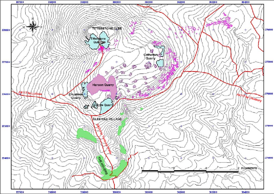
There are few places in Shropshire, or for that matter the West Midlands region, where one can so clearly see the complex and intimate relationship between people and their environment. It is still a living and evolving environment since the landscape includes an active quarry producing the Clee Hill’s most famous product: the Dhustone (black stone) used principally as a graded crushed stone whose doleritic qualities make it valuable to the road construction industry. Visible and substantial remains are quite extensive and well preserved, spanning, prehistory, the Middle Ages, and the early Industries of the 17th-19th centuries. All have left their mark in varying degrees, but perhaps not surprisingly the Industrial Age has had the greatest visual impact on the hill as it survives today (fig. 1). One of the earliest extractive industries upon the hill was the quarrying of limestone for building stone, iron smelting and lime burning.
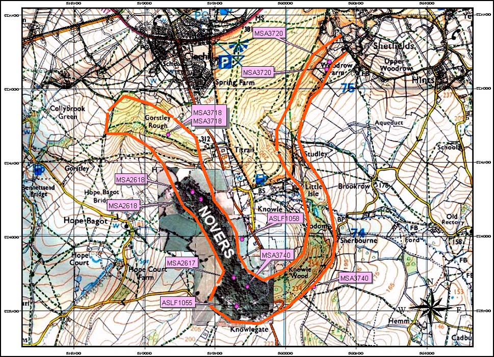
The remarkable survival of the Novers limestone quarry and mine is a microcosm of this industry.
Figure 2: